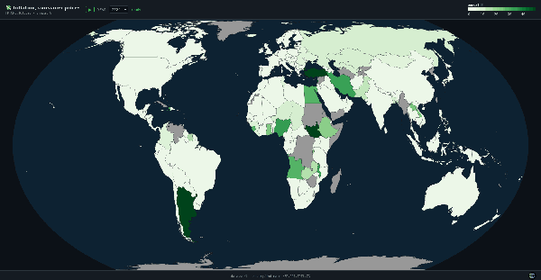
World Inflation Map - Annual Consumer Price Changes (%)
Interactive world map of annual inflation (%) from 1960 to 2024, showing consumer price changes...
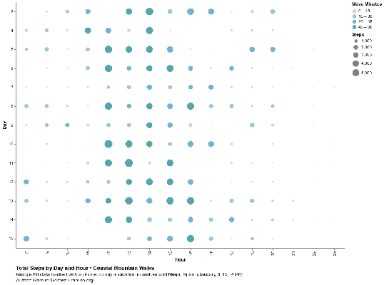
Coastal Mountain Walks: Exploring Google Fit Data
Analysis of Google Fit data from a hiking vacation in Nerja, Spain. Explore daily step counts,...
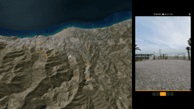
Elevation Diary: Nerja
Interactive 3D elevation diary showing photos from a 2-week vacation in Nerja, Spain, displayed...
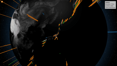
Volcanoes of Planet Earth
A 3D globe showing a selection of volcanoes on planet earth.
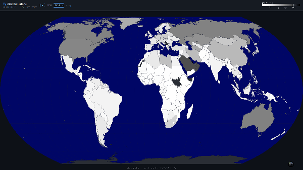
World Map of Countries by CO2 Emissions per Capita
These choropleth maps show CO2 emissions in metric tons per capita based on data from the Carbon...
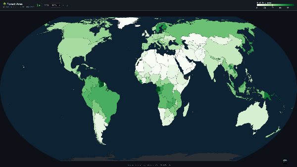
World Map of Countries by Forest Area Percentage of Land Area
These choropleth maps show the forest area percentage of land area for the world's countries...
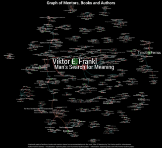
Graph of Mentors, Books and Authors
An interactive network graph consisting of authors, books and mentors based on recommendations...
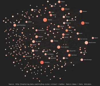
Graph of Big Sister Cities With +1 Million Inhabitants
An interactive network graph showing 279 cities with more than 1 million inhabitants and how...
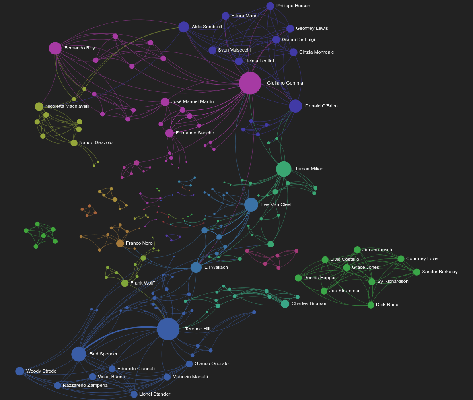
Spaghetti Western Actors Network Graph DBpedia
This is an undirected graph of co-occurrences of actors who appeared in one or more Spaghetti...
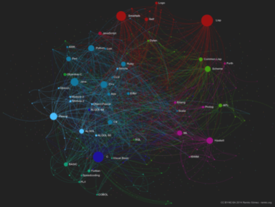
Programming Languages Influence Network 2014
An interactive network graph showing the connections of programming languages based on their...
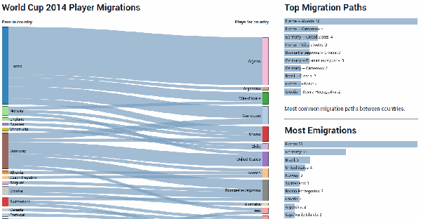
World Cup 2014 Player Migrations
An interactive data visualization that shows the migration paths from players participating in...
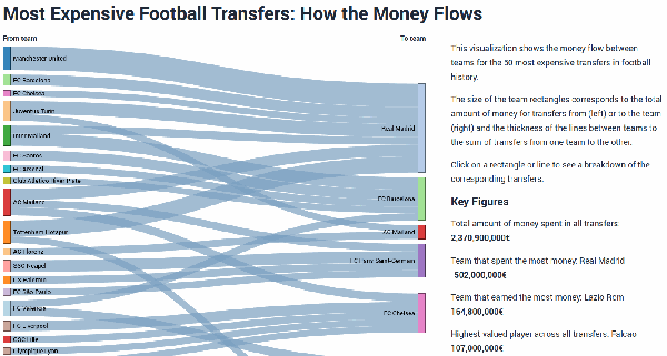
Most Expensive Football Transfers: How the Money Flows
An interactive visualization that shows the money flow between teams for the 50 most expensive...